
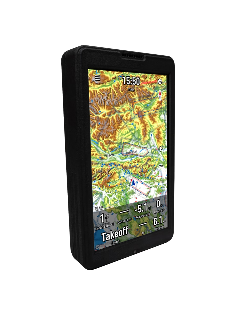
Naviter Oudie N Fanet+
Large 5.5" screen flight computer with FANET, FLARM and ADS-L transmission
Reference : NAV-OUDIEN-FANET
Documentation
- Shipped from Switzerland
- TWINT, card or QR-bill
- Local support
High-end flight computer with a 5.5" Full HD 1000 nits screen, SeeYou Navigator, 15h+ battery life at full brightness, 4G/LTE and Fanet+ module (FANET + FLARM transmit and receive, ADS-L transmit).
Connectivity & visibility
ADS-L Out enabled via a free update. Naviter has yet to confirm in writing the exact version of the EASA standard implemented.
ADS-L
FANET
FLARM
ADS-B & Mode S
You are visible to other pilots (FANET), to gliders and aircraft equipped with FLARM, and via ADS-L. You receive FANET and FLARM traffic; ADS-L reception is not yet active. Eligible for the FOCA subsidy: QR code and certificate provided with the device. Existing Oudie N units can be upgraded to this version.
Compatibility verified on 11 October 2026.
What does this table mean?Why this product?
The Oudie N is Naviter's large-format flight computer, designed for cross-country and competition flying in paraglider, hang glider and glider. Its 5.5" Full HD (1920×1080) 1000 nits screen remains perfectly readable in sunlight, in both portrait and landscape orientation. It runs on Android with SeeYou Navigator (updates included): high-resolution and satellite world maps, Swiss DABS airspaces updated daily with 3D alerts, thermal assistant, arrival calculator, competition tasks (race, assigned areas, FAI triangles) and task scanning via QR code. The Fanet+ version adds the FANET + FLARM radio (transmit and receive); from October 2026, a free module update (version 1.4.2) enables ADS-L transmission, ADS-L reception not yet being active. Without this module, the Oudie N has no 868 MHz radio and can neither transmit nor receive ADS-L. Wi-Fi, Bluetooth and 4G/LTE (SIM card included), more than 15h of battery life at full brightness and more than 64h of recording with screen off. Eligible for federal support (FOCA) for electronic visibility: approximately CHF 72.- per device, via the approved application of the Swiss importer High Adventure (and not via variosubvention.ch) — the device is shipped with a QR code and an explanatory letter for the procedure. Only one subsidy per pilot (FLARM and ADS-L combined), reserved for pilots domiciled in Switzerland holding an SHV/FSVL license; devices purchased abroad are excluded.
Technical specifications
| GPS | Aviation-grade GPS module |
|---|---|
| Wind | Live wind — direction and strength |
| Weight | 430 g (Oudie N value; exact weight with Fanet+ module not published) |
| Radio | Fanet+ 2.0 module: FANET and FLARM (transmit + receive), ADS-L (transmit; receive not yet active) |
| Maps | Worldwide high resolution (down to road level), Relief themes (standard SeeYou), Outdoor and Light, satellite maps (connection required), pre-download for offline use |
| Routes | Yes |
| Screen | 5.5" Full HD 1920×1080, 1000 nits, portrait and landscape, multitouch (pinch & zoom) |
| Content | Oudie N Fanet+ with SeeYou Navigator, SIM card, leather carrying case, universal charger, USB cable, self-adhesive mounting pad |
| Altitude | GPS, automatic QNH, QFE, flight level (FL) |
| Battery | 15 h+ at full brightness, 20 h+ over a typical day with auto brightness, 64 h+ continuous recording with screen off (vario sound active) |
| Sensors | High-precision pressure sensor (<10 cm), high-precision GPS, GPS + Galileo + GLONASS receiver, gyroscope-assisted vario |
| Memory | 4 GB RAM, 64 GB flash |
| SIM card | Nano-SIM included (from 07.2026) — eSIM not supported |
| Controls | Resistive touchscreen + buttons (on/off, volume +/−) |
| Dimensions | 151 × 87 × 25 mm (+10 mm Fanet+/FLARM antenna) |
| Readability | Very sharp LCD screen, readable in direct sunlight |
| Ground speed | Yes |
| Mobile map | Yes |
| IGC files | Yes |
| Flight log | Yes |
| Connectivity | USB-C, USB OTG, Wi-Fi, Bluetooth Low Energy (external devices), 4G/LTE, Wi-Fi and Bluetooth tethering |
| Live tracking | OGN; FANET/FLARM via the Fanet+ module |
| Updates | Online — airspaces and data automatically updated |
| FAI triangles | Yes |
| Charging time | ≈ 6 h empty to full |
| Airspaces | Swiss DABS updated daily, special zones included (aerodromes, wildlife sanctuary zones, heliports); custom airspace files possible |
| Online functions | Rain radar, OGN (Open Glider Network) display, KK7 skyways and thermals, online competition upload, SeeYou Cloud sync; TopMeteo / SkySight forecasts and satellite images (provider subscription required) |
| Cross-country optimization | Yes |
| Open Glider Network | Yes (display via mobile network) |
| Multilingual interface | Yes |
| Task settings | Yes |
| Usable with gloves | Yes |
| Thermal assistant | Yes |
| Airspace info | Class, floor and ceiling, horizontal and vertical distances, radio frequency |
| Navigation software | SeeYou Navigator, updates included for life |
| Operating system | Android |
| Airspace alerts | 3D, with side view |
| Multiple map pages | Yes |
| Competition functions | Distance tasks, racing, assigned areas (AAT), time-based tasks, free flight |
| Airfield database | Yes |
| Map / waypoint settings | Yes |
| QR code scanner for tasks | Yes |
| Waypoints | Yes |
| Customizable vario sounds | Yes |
| Take-off / landing database | Yes |
| Customizable menu buttons | Yes |
| Final glide calculator | Yes |